


LA CELLE

clintest
User
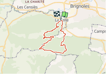

Length
14.5 km

Max alt
769 m

Uphill gradient
698 m
Km-Effort
24 km

Min alt
245 m

Downhill gradient
695 m
Boucle
Yes
Creation date :
2024-10-04 14:06:53.533
Updated on :
2024-10-04 14:07:32.107
5h24
Difficulty : Medium

FREE GPS app for hiking
 SityTrail
IGN / Geographical institutes
SityTrail Plus
The world is yours!
About
Trail On foot of 14.5 km to be discovered at Provence-Alpes-Côte d'Azur, Var, La Celle. This trail is proposed by clintest.
Positioning
Country:
France
Region :
Provence-Alpes-Côte d'Azur
Department/Province :
Var
Municipality :
La Celle
Location:
Unknown
Start:(Dec)
Start:(UTM)
260225 ; 4808792 (32T) N.
Comments